Image Credit: Visitscotland Kenny Lam
Edinburgh has many safe and interesting cycling routes which can be enjoyed by all ages. From off-street paths, former railway lines and sea view esplanades, there are cycling routes to suit most abilities.
Let’s explore some of the city’s most popular trails.
Cycling favourites
1.
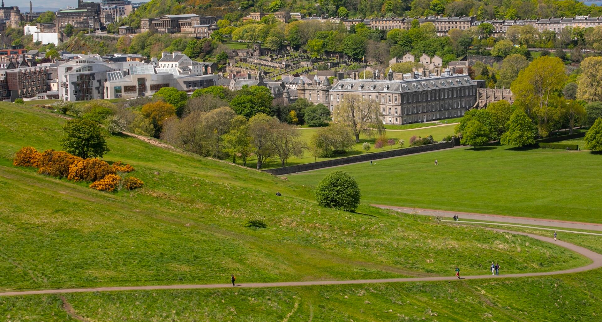
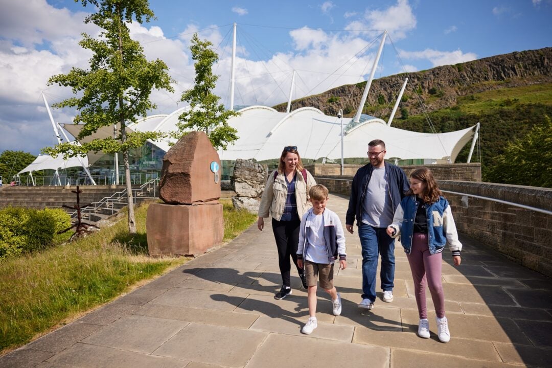
Holyrood Park
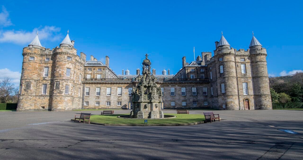
At the foot of the Royal Mile, Holyrood Park offers spectacular cityscape views and a well surfaced road for cyclists.
You can follow the road west and then north from the roundabout at the Holyrood Park Road entrance passing Dynamic Earth, The Scottish Parliament and The Palace of Holyroodhouse. The route ends at St Margaret’s Loch which is an excellent spot to catch your breath (there are some steep hills) and admire the swans.
Edinburgh North
Cycling routes to the north of the city are made up from the many disused railway lines which once traversed the area running from Granton and Leith to Haymarket and the city centre. The majority of these paths have good surfaces, lighting and a gentle gradient.
2.
Leith and Portobello
Starting at the wide grasslands of Leith Links, take the cycle path along the north edge and across the modern bridge at Seafield Place. This popular cycle route has, in recent years, been upgraded and widened along a section of Seafield Road, making it suitable for shared use by pedestrians and cyclists leading on to the Portobello Promenade.
3.
Roseburn and Blackhall
The Roseburn Path which links Edinburgh to the north of the city is one of the most popular cycling routes in Edinburgh.
Connecting with the Telford Path, it provides access to the high street stores and supermarket at Craigleith and the nearby Western General Hospital. If you continue south it passes under Queensferry Road and along the Ravelston Dykes area before concluding at Haymarket Yards at Haymarket Station. Alternatively you can head north west at Craigleith junction and travel on to Davidson Mains. The path ends in Cramond Road South, but why not explore the quieter residential roads of Barnton and Cramond Brig?
4.
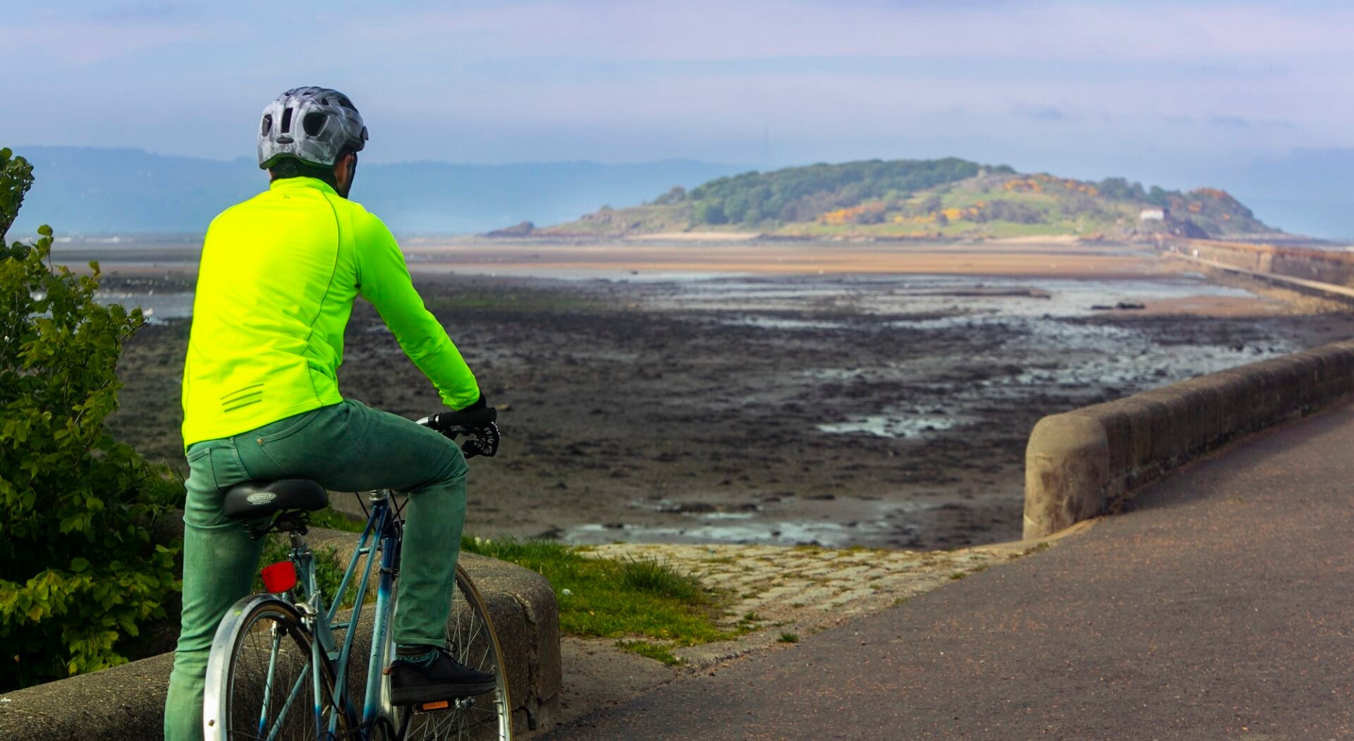
Silverknowes and Cramond
The esplanade at Silverknowes is wide and smooth with superb views over the Firth of Forth and a popular spot for cyclists, dog walkers and rollerbladers.
The esplanade can be quite busy in summer as many residents and visitors enjoy a stroll and an ice cream as they walk along the esplanade to the old fishing village of Cramond with its pretty, white-washed houses. Overlooking a picturesque harbour dotted with small, colourful sailing boats you can park your bike and enjoy a refreshment in the local coffee shop. On a fine day, a walk along the causeway to Cramond Island is a popular choice for many people. Just be aware of the tide times.
Edinburgh South
Image Credit: Visitscotland, Kenny Lam
5.
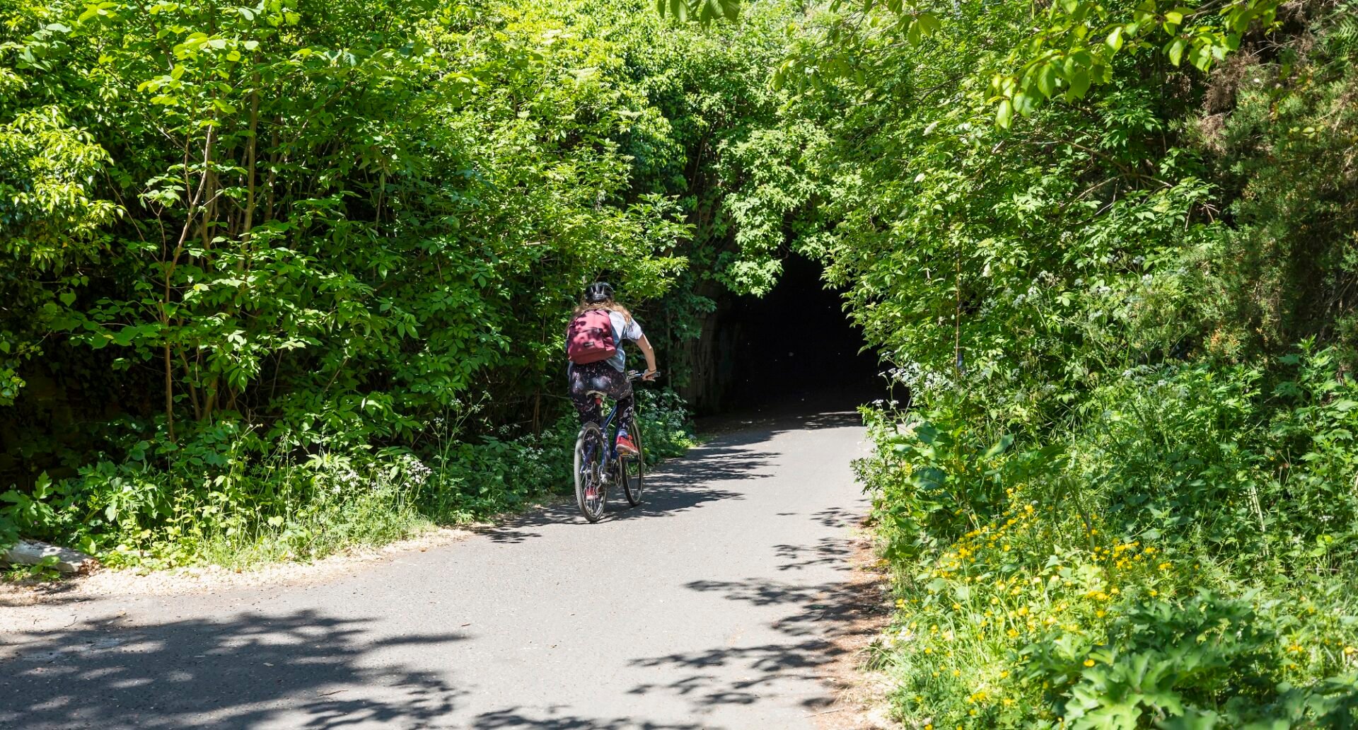
The Innocent Railway Path
Originally a horse-drawn tramway constructed in 1831, the Innocent Railway Path was used to transport agricultural produce and coal from the Lothian mines to St Leonards.
Nowadays, it’s the longest cycle route in the south east of the capital and part of the UK-wide, National Cycle Network’s Route 1 (NCN1). Starting at St. Leonard’s Tunnel in the East Parkside Estate off Holyrood Park Road, you can enter the cool, but dimly-lit tunnel, before exiting on to the majestic surroundings of Holyrood Park. This green cycle path travels on to Duddingston, Niddrie Mains and onwards to Brunstane.
Image Credit: Visitscotland Kenny Lam
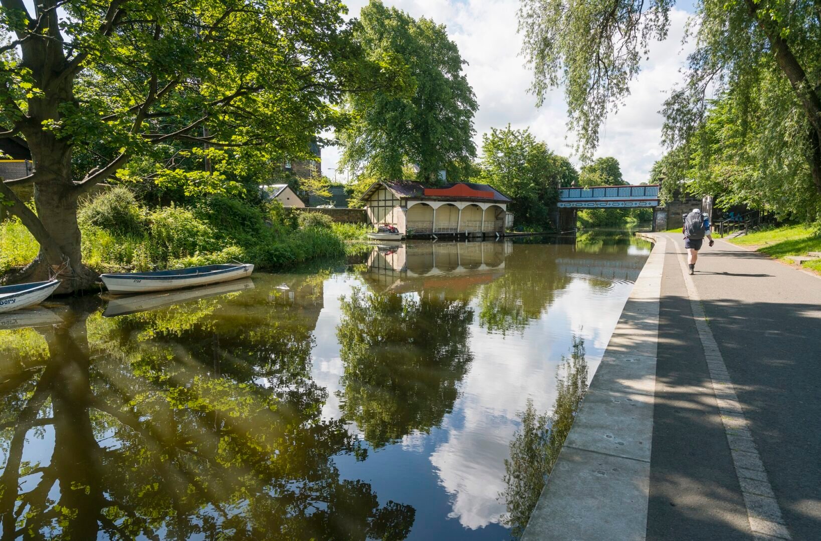
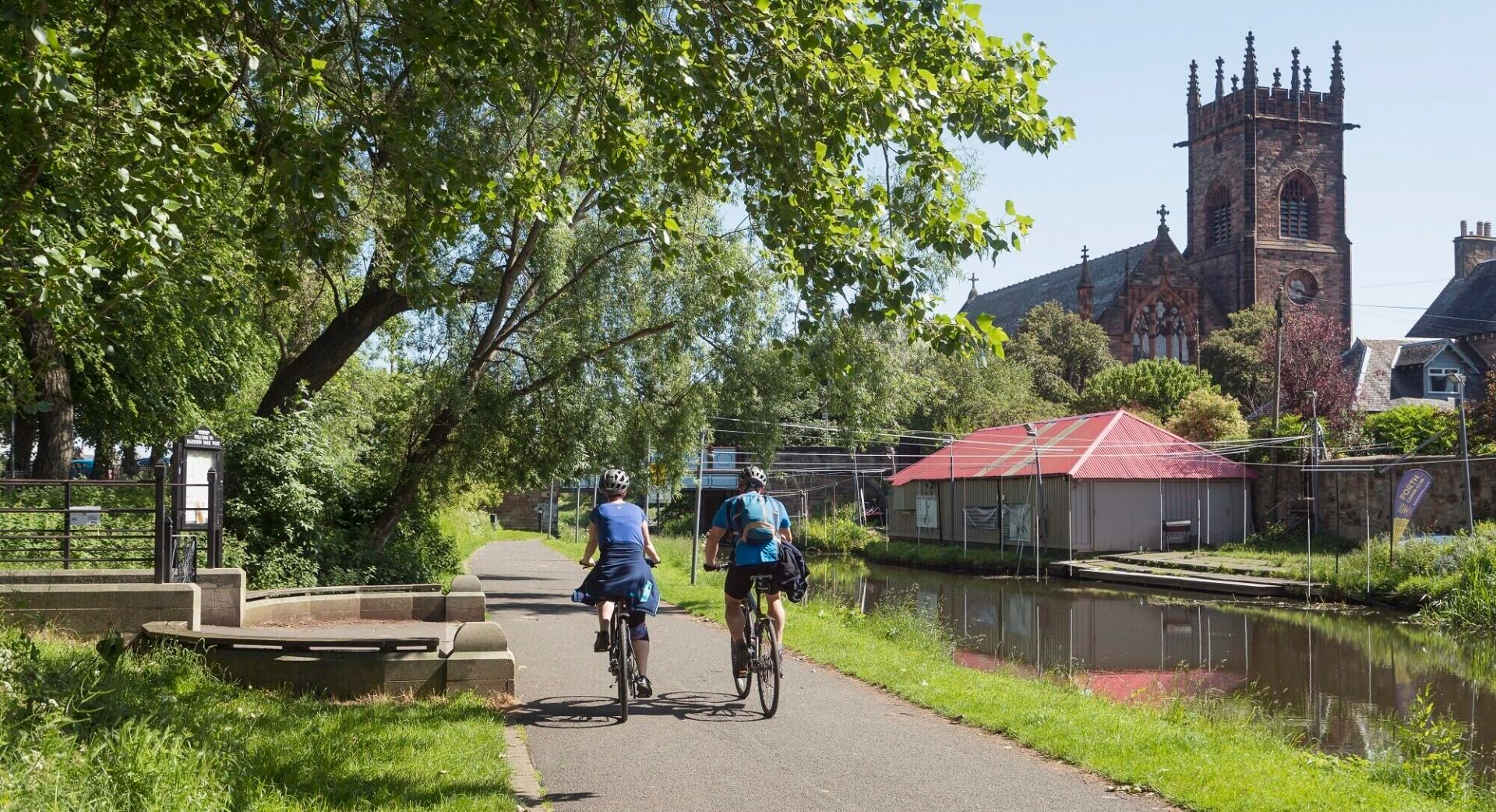
6.
The Union Canal
Running south and west of the capital, the Union Canal is a popular choice for cyclists as it is flat and completely traffic free. You will, however, have to share the path with anglers, dog walkers, runners and families out for a quiet stroll. Starting at the Lochrin Basin in Fountainbridge it travels all the way from the city to Ratho and beyond.
7.
The Water of Leith
Starting in Leith, this popular (and primarily a walkway) route stretches 12 miles to Balerno.
The initial riverside stage of The Water of Leith is probably best suited to walkers. You can cycle and once you reach Roseburn Place near Murrayfield, cycling improves and the route continues across Balgreen Road and Gorgie Road before ending at the Water of Leith Visitor Centre. The next section of this route is quite narrow and can be steep and difficult to navigate in places. As an alternative, you could take the Lanark Road and rejoin the route at Redhall Bank Road. A less taxing route is offered from here to Colinton and Balerno.
Useful Resources
Below are links to some other Edinburgh cycling websites which may be of interest for further exploration.
- Cycle to South Queensferry from Edinburgh on the John Muir Way.
- Innertube Map charts Edinburgh’s main off-street cycle routes.
- Cycle Streets for Edinburgh lets you plan your route in the capital.
- Cycling Edinburgh is a great site featuring organised bike rides in and around Edinburgh run by local cycling clubs, groups and individuals.
- Edinburgh Bike Tours provide guided group cycling tours of Edinburgh’s highlights.
- City Cycling Edinburgh Forum will keep you up to date with the latest cycling news, views and questions.
What’s your favourite cycling route in Edinburgh? Share your images using #ForeverEdinburgh and #edinphoto.
Share
Listings on this page
-
Family-friendly
Enjoy great family days out in Edinburgh with our entertaining list of activities to keep the kids amused!
-

Free Attractions
As the phrase goes – the best things in life are free.
-
Luxury City Guide
Spoil yourself with our guide to the top things to do in Edinburgh for the perfect day…
-
Literature City Guide
Home and the inspiration to many great writers, Edinburgh is rightly proud of its accreditation as the…
-
Heritage City Guide
Accredited in 1995 as a World Heritage Site by UNESCO, Edinburgh’s impressive architecture seamlessly blends the character of the medieval Old Town with the splendor of the Georgian New Town.
-
Haunted City Guide
Uncover the dark side of Edinburgh’s history. Are you afraid of the dark? Edinburgh has…
-
Romantic City Guide
Edinburgh is the perfect city for a romantic short break. From fine dining and tranquil walks, it offers something to melt everybody’s heart!
-
LGBTQ+ city guide
As a warm and welcoming city, Edinburgh has a thriving LGBTQ+ friendly scene.